
First let me say that neither Google nor Live showed the correct building for all but one of my searches. Most of the time when I put in an address the house it indicated was one or two off but sometimes they were off by several. So if you are not familiar with the street you are looking at do not assume that the location that comes up is correct. I'm not quite sure how you could go about verifying a location you haven't been there so suggestions are welcome. At least you'll get an idea of what the neighborhood looks like today. Another problem with both was that some locations you could zoom into better than others.
This is my grandparents house in Syracuse, early 1960.

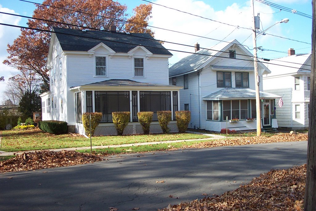
I went and took this picture myself in 2006 when I wrote Syracuse Baby Camp. Not much change in 46 years.
First let's look at Google Earth. You can just make out the little icon that indicates which house and it is off by one. When I tried to zoom in further it just got fuzzy.

Google Earth does have a neat feature where you can rotate the image to any angle you want. You can now see things in the back of the property that were obscured in the first view.

Live maps gives you two options, aerial or birds eye view. Here is the aerial. Much sharper than the Google image. The address was off, indicating one property to the north. I removed the large red arrow that tends to get in the way by putting in a nearby address.

And the birds eye view. This time the arrow indicated the property as the one to the south! This gives me quite a bit of detail and clearly shows the addition in the rear. Because I cannot rotate the image, the house to the south blocks most of my grandparent's. You can close the little box with the surrounding map by clicking on the arrow.

I was able to find Mike and Sarah Camfield's farm to go along with the letters I am working on and for a large property these images are great. The satellite images can't compare to the two street view pictures but they do let me see that the house is still there and I could zoom out to get views of the neighborhood.
I was surprised to be able to pick out a particular monument in Phoenix Rural Cemetery. This might be a great tool for marking grave locations while they are still fresh in you memory so you can find them again. Look at the two monument pictures and then at the Live Map image. Being familiar with the cemetery I'm fairly certain I was able to zoom in on the right spot. What do you think?


My search for Silverbrook Cemetery, Niles, MI was not nearly as detailed. You cannot zoom in more than this at this location.
 Have fun playing around with it, maybe your location will be well covered.
Click on "playing around" at the beginning of this post to see other examples of images I found.
No comments:
Post a Comment